BACK TO CANYONLANDS NATIONAL PARK
Islands in the Sky
Our third exit and re-entry to the Canyonlands Park was the district furthest north called, descriptively, Islands in the Sky-the confluence area of high mesa between the Green River and Colorado Rivers. As I mentioned in a previous post, we had to leave Canyonlands Park to access Islands in the Sky district, and Moab and Arches lay conveniently on the way, so we visited those first, entering Islands in the Sky on rt. 313 from the north.
Early arrival at the camp area was strongly suggested and we came in at about 10:30 in the morning to set up camp, then zoom off on road exploration on the bike. This area provided more stunning colors in deep, really deep, canyon scenery along the main road, turnoffs, a fabulous 4X4 drive on Shafer Road and a great campsite.
Returning to our camp later in the day now with our water and wood we noticed workers were just installing wooden lattice sunscreens over the picnic tables, which helped keep the temperature down considerably during the day. The campsite was treed minimally and sparsely; sinew-like branches barely tall enough to be overhead and a few gnarled juniper bushes. Dan found it photogenic, as I climbed to the top of a cliff suggested by a beemer riderwe met in the park.
The downside of the campsite was lack of water available and the bugs. Despite repellent, we needed a fire to keep the mosquitoes and gnats away. The decision was made not to stay another night when we both noticed the itching and red bites the next day. At first we thought mosquito bites, but after checking on-line- gnats! Vicious little biters; the effects were felt for weeks after. Incredible!
Shafer to White Rim Road and back
Still, there was lots more exploring to do at Islands in the Sky, so we filled our water bottles, leaving the bike at the campsite, signing up for another night anyway, and started for Shafer Road in the Subaru. Shafer road falls precipitously toward Shafer Canyon, and on toward the White Rim, a horizontally oriented white limestone rock edge. We knew we would have to turn back sometime as the road was closed up ahead due to a rock slide. Down the dusty, steep road we went.
Dan had seen the road from the overlook and watched a jeep blasting back up in a cloud of dust and figured he could make it in and out also. We continued down the dirt road until it leveled off and branched; left toward the town of Potash where I read we could see a potash mine and great scenery, but needed a really high clearance vehicle. If you drove that way theoretically one could return to Moab on this 4X4 road. All the books said you could. We did have extra water, a pump and a real spare tire instead of the "donut" the Forester is sold with, but we had had a slow flat after a ride in Big Bend so we were cautious.
When the time came we continued right at the fork and then farther into the canyon. The first stop on what was going to be 15 miles of downhill hairpin turns, rocks and narrow ledges was at Gooseneck Overlook, a wide area to park and where we walked over slickrock and up a rise to look into the Colorado River as it snaked through the canyon below. The famous Cataract Canyon rapids run through this district but we did not see rafts the day we drove there.
Beyond the overlook, continuing on past stone-wall cliffs, hundreds of feet of towering rock face above the rocky, dusty road, Dan drove until, when we walked ahead ,we saw the road, narrower, and much closer to the canyon rim overlooking the river and struggled to find a place to turn the car around! I walked back toward where I had seen a small indentation and Dan backed to it, successfully turning around so that after the 30 miles or so trip we could be back up to Shafer Overlook ,the visitor center ,and our Willow Mesa campsite.
Looking back up toward the entry we had used and worrying just a little about the capability of the Subaru, we had some thoughts of driving back to the junction where the road went left and our map showed it ended in Moab. We did need fuel and ice and seriously considered heading that way, but weren't sure enough of the conditions. We continued back the way we came knowing it was steeper and rockier than we had anticipated. All went well and many bumpy miles later we were approaching the last mile. We came through the new construction and scaled the last hill, covering the patch of loose sandy soil and in our own generated dust cloud we were out of the canyon. We pulled over, drank some water ate our banana and tuna late lunch and thought ahead.
Now considering our need for fuel in the car and ice before the next part of our trip north towards Idaho, we needed to return to the closest town, Moab before heading on in Utah. Poor planning on my part but Dan drove back to Moab on the main road to 191and I drove back while he dozed and we returned to our campsite for another night, happy for the Shafer adventure, and exhausted.
Enjoy the Canyonlands-Islands in the Sky slideshow
 |
| 10 UTAH Island in Sky, Shafer Rd. 4X4 |
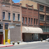
Moving on the next morning on rt. 191/6 Dan riding, me driving we made our way through the areas I was to find out had been the most active mining areas historically, the town of Price and onto rt 6. Our rest stop in the historic town of Helper was just by accident. Driving in I saw a sign for a Mining Museum and since we had skipped a recommended mining museum in Jerome, Arizona, and not being as tired as Dan, I decided to make a quick stop. Quick it was, but for a small space the Western Mining & Railroad Museum was great!
I basically ran through the museum, camera in hand, picked up the useful brochure gave my $5 contribution, and joined back up with Dan for lunch in Helper- but since then I've been thinking about the information. We got back on the road, this time rt. 15 to Sandy City, below Salt Lake City, for a checkup on the BMW. Dan thought it had been burning too much oil, but supposedly not.
Staying the night in Sandy City we moved on toward IDAHO still on the hair-raising main highway. Driving is not my forte. I don't like to drive, especially in traffic- now add the trailer! Dan had no real problems driving the bike, but found himself always waiting for me. Duh, he has a motorcycle.
To the Moon- Craters of the Moon National Park
Happy to reach another border, Idaho, even though it was raining gently and a bit chilly for Dan we moved on towards Pocatelo and Blackfoot, then onto rt. 26 the next day, probably. Out of curiosity we made a short stop at the next National Park we came to, Craters of the Moon. The lava information given on the short walk was interesting. Such black, black soil and crusted and jagged formations. Formidable landscape.
Enjoy the slideshow of the Western Mining and Railroad Museum, entering Idaho and Craters of the Moon.
And beyond
Before we rested this second day we had to cross some of the highest mountains in IDAHO; Sun Valley ski area where melting snow increased the water and volume in narrow mountain streams and the swirling snowy summit at Mt. Galena. Continuing around and down into the valley below, we found a nice, wild campsite complete with pronghorn and deer. Our area was a bit wet under the pine needles. We made a big fire, early to bed and were cold but ok!
 |
| 11 UTAH Helper Museum to Galena Summit Idaho |


No comments:
Post a Comment