|
| Dan and I saw bears but only from the wildlife bus and sometimes a large distance. |
 |
| One of many viewpoint along the wildlife drive. No private cars are allowed here. We were able to camp at Teklineka Campground and enjoy two days of the bus shuttle. |
 |
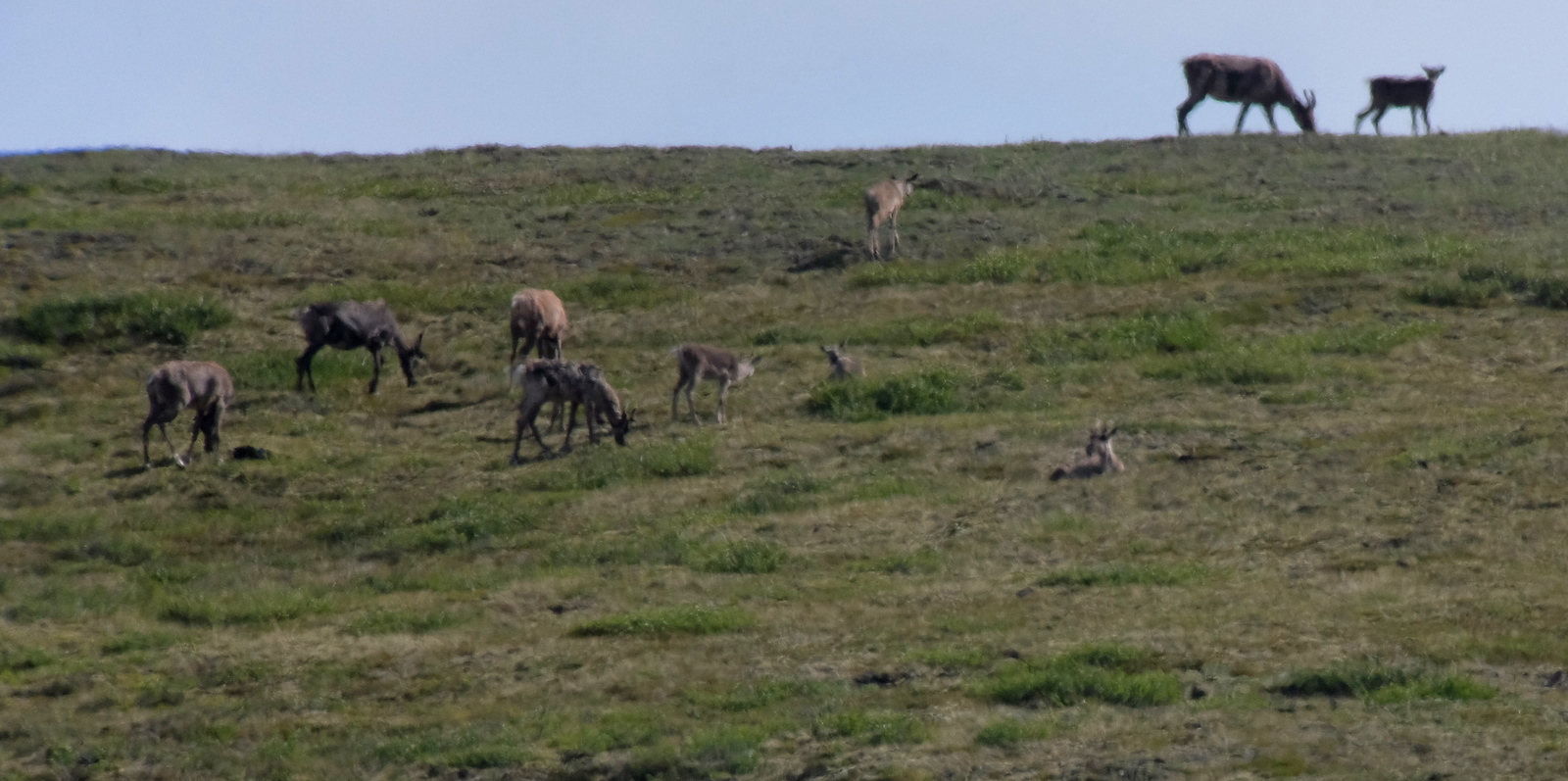
| Caribou in the distance |
 |
| Mount Mckinley and Denali are the same mountain. Denali honors the aboriginal First Peoples as it is their chosen nane for the mountain. |
 |
| In rutting season sometimes moose can lock horns and never become free. They would have a horrid death. |
 |
| Mirror Lake one of our many stops. |
 |
| A very fuzzy picture of a hiding moose from the bus. |
 |
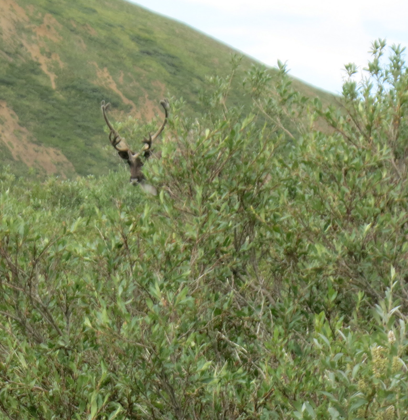
Incredible caribeau antler display! |
 |
| National Park program to engage children and make them "Jr. Rangers" and Mom and Dad can hike and explore on their own. |
A Map to show the journey and many, many miles we traveled. We were to meet cruising friends in Denali and camp together so it was time to move on from Dawson in the Yukon territory and cross into Alaska.
Well OK map info was not included. Lots and lots of miles! But lots to do and see.
 |
| A rider we met on the road to Alaska Border |
 |
| The Alaska Border |
 |
| Beauty in July into August |
Route 9 Yukon Territory took us from Dawson City to Route 5 Taylor Highway,
"Taylor Road (also called Beam Rd. or Kougarok Rd.) spans 85 miles (North) and takes 2 hours one-way without stops. For a journey back through the era of the gold rush, this is the perfect drive, as it winds past many of the old mining claims. In the distance, along the side of the hills, look for straight horizontal lines: These are ditches that were dug, by hand, to transport water to the claims years ago. You’ll also be able to see some old railroad bridges and tracks""
Obviously- the 85 miles would take much longer dragging our Escape. Roads are sometimes paved not always, and quite narrow.
Driving from the Alaskan Border, the Top of the World Highway to Chicken, AK along the route of much gold prospecting, even now in modern day.
 |
| One of the ehibits in the town of Chicken |
 |
| Learning to pan for gold at $12 an hour. |
 |
| Playful use of the "Chicken'" that happened all through the town. Sign says "Beware of Attack Chicken" |
 |
Leave something in Chicken. Tourest memorabilia
|
We chose not to visit Eagle. That's much farther north on a dirt road. The ride along the steep river valley on dirt and mud to Chicken was excitement enough. Too narrow to even pull off the trailer and take a picture.
So we head south to Tok and Route 1 Alaska Highway to Fairbanks.
,"
Fairbanks, Alaska's second-largest city, is a former gold-rush town with a cutting-edge university-and it still holds onto its fiercely independent roots. Tour old gold mines, take a historic riverboat cruise, or just wander around downtown.
and on Route 2 through Whitehorse and 6, The Steese Highway, to Chena Hot Springs, our Northernmost point in Alaska.
 |
Zoom to see roads better
A Map to show the journey and many, many miles we traveled is below We were to meet cruising friends in Denali and camp together so it was time to move on from Dawson in the Yukon territory and cross into Alaska.
Lots and lots of miles! But lots to do and see.
|
Click this link to see a map overview of some important stops on our trip
Alaska Trip
I will get straight to the pictures, after a few copied words below. It would help to orient the reader if you opened a roadmap of Alaskan roads. We drove many of them.
Route 9 Yukon Territory took us from Dawson City to Route 5 Taylor Highway,...
Taylor Road (also called Beam Rd. or Kougarok Rd.) spans 85 miles (North) and takes 2 hours one-way without stops. For a journey back through the era of the gold rush, this is the perfect drive, as it winds past many of the old mining claims. In the distance, along the side of the hills, look for straight horizontal lines: These are ditches that were dug, by hand, to transport water to the claims years ago. You’ll also be able to see some old railroad bridges and tracks
the Alaskan Border, the Top of the World Highway to Chicken, then to Tok and Route 1 Alaska Highway to Fairbanks.......
,
Fairbanks, Alaska's second-largest city, is a former gold-rush town with a cutting-edge university-and it still holds onto its fiercely independent roots. Tour old gold mines, take a historic riverboat cruise, or just wander around downtown.
and on Route 2 through Whitehorse and 6, The Steese Highway, to Chena Hot Springs, our Northernmost point in Alaska........
 |
| Dinner in Tok. One plate of nachos. |
 |
| A few days later we have passed through Fairbanks for supplies |
 |
| Seen the Chena Hot Springs |
 |
| And camped here, where after my 9:00 pm walk in the river -at the 10:00pm pic below I missed a pic of a fisherman slogging out of the water into this scene from our trailer window. Wow was I startled! |
 |
| Arriving at Denali National Park |
Retracing our steps, Route 3 took us to Parks Highway and Denali National Park,.....
The incomparably beautiful Denali is the pinnacle of many travelers' Alaskan visits. The park holds six million acres of lakes, tundra, peaks, and wildlife dominated by North America's highest peak and interrupted by a single 90-mile road.
where we entered the park, camped and shuttled, to gaze in awe at mountain scenery, animals and rivers. Six days later we left the park, and our friends Terry and Barb, and traveled South and on through Anchorage,,,,,
 |
| Barb and Terry- boating friends we met in Denali Park for six fun days |
 |
| Next morning the bus picks us all up at the campground - first we choose to visit the Husky team area. |
 |
| The ranger |
 |
| The dogs were resting when we arrived, either on the ground or on top of their doghouses. |
 |
Doghouse in background. Socializing the working dogs that are used for carrying goods and some people in winter.
Today they were going to do a short run with weight to show how they harness and mush. |
 |
| She is a leader. Each dog has a roll in the mush. |
 |
| Dog harness |
 |
| Museum at Husky area |
 |
| Getting the dogs ready for their run. |
 |
| They are more than ready and happy to be ready to run and pull. |
 |
| Not huge space but cooking indoors. |
 |
| At our campground. We were happy to have the trailers because the rain was significant one night. Some tents blew over. |
 |
Night at Teclanica campground
Er... enjoy the Denali Photos again as apparently I forgot I had already posted them!
|
 |
| Next morning we are back on the wildlife viewing bus. In two days we saw 16 bear,mostly grizzly but black bear too, hundreds of caribou, two moose many mountain goats from a distance and dall sheep. |
 |
| In rutting season sometimes moose can lock horns and never become free. They would have a horrid death. |
 |
| Mirror Lake |
 |
| Saw a Perigrine falcon here. |
 |
| Young Ranger program |
 |
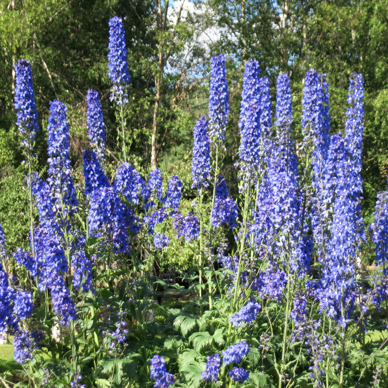
| Alpine flowers |
 |
| Terry and Barb in Alpine meadow AGAIN but I think the rest of pictures are new! |
 |
| Caribou poop |
 |
| bear poop |
 |
| Afternoon walk |
 |
An impressive old guy with his bicycle and motorcycle with trailer.
He biked the road the bus tour took. |
Reorient the sequence:
The drive from Anchorage to the seaside community of Seward begins with two hours of spectacular views as you pass between the dramatic shorelines of Turnagain Arm and the jutting peaks of the Chugach Mountains.
and Turnagain Arm,
 |
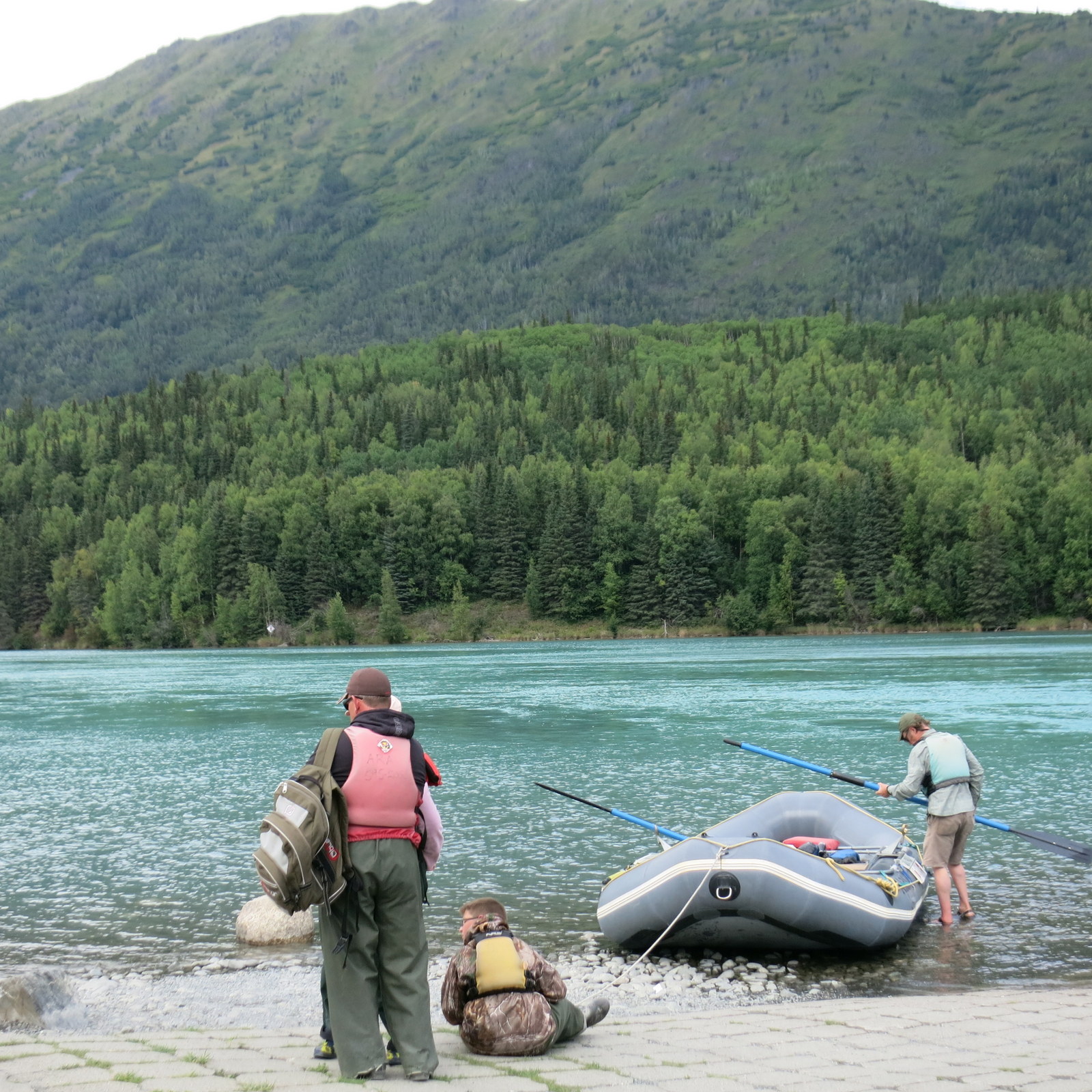
| HOPE AK is a place at the Seven Mile River where Dan and I took a rafting trip. We have no pictures of us as we were afraid to lose the camera.! |
Area around Hope and up a steep mountain without trailer.
 |
| I saw this 15 yr. old catch a nice salmon but he threw it right back in as he had snagged it not hooked it and he was" not going to break the law" he told his father. Salmon are a fisherman's dream in Alaska but it is difficult for a traveler to decipher the rules. The boy explained the fish must take your bait and snags must be put back. |
 |
| This is Hope Alaska where Dan and I did a rafting trip along the Seven Mile River and through two of the canyons. It was a blast-but no pics as we did not take a camera! |
 |
| Looking down at the river |
 |
| A hike we took in the mountains. |
 |
| River water underneath this tressel is called Hell's Canyon |
 |
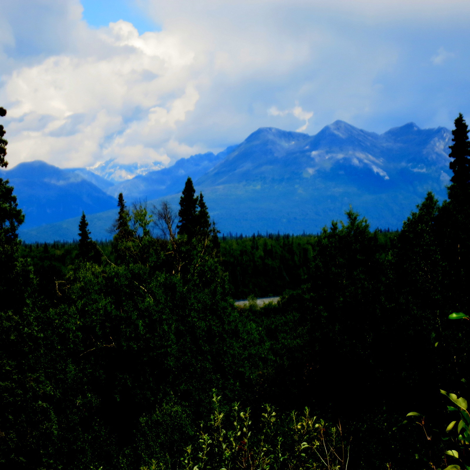
Denali State Park has a great view of Mt. Mckinley or Denali at times. We tried but had cloud cover. We came very close to achieving a mountain top view but not for long. We chose not to take an aerotour over Denali because of the obscured visability. |
 |
| Mural of the named peaks |
 |
| Cloudy moutain range |
 |
| stopping at Talkeetna, Just two hours north from Anchorage, Talkeetna is a town with authentic pioneer feel and modern tour and lodging facilities. You'll find gorgeous flightseeing, world-class fishing, and the staging ground for climbing expeditions. All McKinley expeditions must register and stage from Talkeetna. It is a place with a view of McKinley when the mountain is showing. |
"
Driving non-stop from Anchorage to Homer would take a good 4.5-5 hours. However, you'll find plenty of reasons to pull over on the drive south: Wildlife often appears along the roadside. Pullouts offer photo opportunities of whales, waves, and volcanoes. Trailheads lead to fabulous alpine and ocean views. Restaurants offer lunch breaks beyond the usual fast-food fare. Enjoying all the scenery and activities along the way could easily stretch this trip into a daylong adventure".
The
Hatcher Pass to Wasilla (remember Sarah who could see Russia from here porch?)and on to sunny, beautiful
Seward where we toured glaciers by land and sea at
Kenai Fiords National Park.
 |
| Crossing the Hatcher Pass to Wasila we climbed a bit with some adventurous families. |
 |
| That's us down there. The road was a bit narrow for our trailer but we made it! |
 |
| The white objects below are a set-up for a wedding near the lake. |
 |
| Popular place for family gatherings. There was a gathering on the mountain that day. |
 |
| Colors were much more vivid than they appear. |
 |
| Good day for blueberry picking in Dan's hat! |
 |
| What a road! |
 |
| Shows road through the Hatcher Pass- just a bit tight for our trailer. |
ONWARD TO SEWARD
Three days there, watching fishermen and bears and camping right on Resolution Bay, then we traveled West on the Sterling Highway....
The Sterling Highway begins at the Tern Lake Junction of the Seward Highway and stretches 142 miles to the town of Homer. While the highway is open year round, it is much busier during the summer months, as it leads to some of the best fishing spots along the Kenai River.
 |
| More salmon fishing. |
 |
| At the visitor center. How big is a bear? |
 |
| Beaver- have many less than in the early rush days |
 |
| You haven't liveduntil you have heard a marmot whistle! |
 |
| Dall sheep |
 |
Halibut cleaning near Homer, AK
and South to the fishing city of Homer and the end of the road at Seldovia at Kachemak Bay....... |
 |
| Beautiful fish but it catapulted out of the water and died looking for love. |
 |
| Homer's Harbor with all kinds of boats; commercial and pleasure. |
 |
| I just loved this picture posted in a ladies room at the harbor. It was for sale for $100. RUN! |
 |
| We took a long ride passing through the fishing, tourist town of Homer and down another long road leading to a large seemingly shallow bay- needing 4x4 assist--down down until we were in another world. Seemingly Slavic pe0ples in a very small village right on the bay. We did not take pictures as we were obviously out of place. Grannies, kerchiefed and heavy dress and Gramps tall leather boots walking the muddy, steep roads. |
 |
| The muddy dead end at Kechimak? Bay. |
 |
A working farm |
 |
| Back through Homer to our campite next morning our very own cialis commercial! |
 |
| This is how boats are launched - with a tractor push. They are pulled out the same way at the end of the fishing trip. |
 |
| We watched a Canadian couple go off for a halbut, salmon trip. They were sucessful and sent all their catch home! We then all had our hotdogs back at the campsite.. |
 |
| On the beach waiting for the fishermen to return watching shore birds. |
 |
| Still Homer- close harbor to our campground |
....
Not wanting to miss what we heard was the prettiest town in Alaska, we headed back through Anchorage, revisited the Turnagain Arm,- it had been raining when we passed the first time-, and Potter Marsh area then headed East over the Talkeena Mountains to VALDEZ......
"The drive from Anchorage to Valdez takes 6 to 7 hours on average. But, there are many scenic vistas and unique places to stop along the way making it easy to spend more than 6 hours on the road. You will have views of several mountain ranges, and glaciers.
Where can you drive to see an amazing glacier, a museum with a saloon, and an old town site in a little over 30 minutes? The 32-mile trip from Valdez to Worthington Glacier is short, but worthwhile. The drive itself is beautiful, with this span of the Richardson Highway just alongside Lowe River"
. on the Glen Highway and Richardson Highway, Route 4.....
"
Paved and well-maintained (with some rough patches in winter), this 125 mile drive is a great way of seeing Alaska’s backcountry. While it is a beautiful drive year-round, locals have said their favorite time to take the Tok Cutoff is the fall and the spring, not only for the changes in flora, but for the start of migrating caribou!"
seeing again much evidence of the aboriginal indians and their lifestyle of subsistence.
All the way the looming Mountains of the Wrangall St. Elias Range are prominent in the scenery.
We passed through the Tetlin National Wildlife Refuge, Kluane Sanctuary,
back now into Canada's BC, South on Route 37 to Hyder and Seward
and Route 16 to Prince George and then a revisit to Chilliwack on Route 97 along the Fraser River.
We skipped over Vancouver to save time, and headed into Oregon.