Jamaica was now behind us; our time spent there was only twenty-four days. It had taken a full day and night of travel, but we had sailed west along the southern Jamaican coast until our course turned more southerly, having 220 nm to our first overnight stop at a tiny spit of sand and reef called Baho Nuevo.

In this copied chart, Port Antonio would be just where the picture cut off- the NE part of Jamaica.
When we left, we sailed to the SE corner and then west along 2/3 of the south coast, then we made a more southerly turn and headed east of Pedro Banks (not shown) toward Baho Nuevo, 220 miles away. From Baho Nuevo we had 80 miles to Serrana Bank and another 40 nm to Roncador. Eventually we would head the 90 nm to Isla Providencia. As you can see, these Colombian owned reefs and cayos are not near the country of Colombia., nor the United States. More on this later.
Dan and I were very happy both to be traveling to the outlying reefs, and to have the company of other boats while making this excursion. We had visited Roncador two times previously and this seven mile enclosed reef still had fascination for us. Visiting there, snorkeling-maybe diving- with the colorful and varied reef inhabitants was an experience never forgotten. That memory had been the greatest draw onward from the Bahamas, and traveling in relative security provided by the presence of the two other boats, Jupiter's Smile and Wind Dancer, made us feel more comfortable going that distance from the beaten track.
Barb and Jay expressed willingness to go off their own schedule and explore with us. We told them how wonderful we thought the area was and they were as excited as we were to stop at three places; Baho Nuevo, as a rest stop, Serrana Bank, and Roncador Bank. They just had to remain cognizant of the time possibly required to meet up with their family visitors in Panama, so it was time for them and us to move on from Jamaica. Ron on the other boat had heard about the reefs and also wanted to go to Panama. Like us, he was keeping Jupiter's Smile's path in mind, knowing as a single-handed sailor, he would do better to stick with us, have fun, take shorter passages and eventually accompany Jupiter's Smile to Panama.
At 4:45am, April 29, 2012 we three picked up anchors in Port Morant and tracklined for Baho Nuevo in 12-14 kn wind and 5-6' seas with current against us, especially as we rounded the southerly point of Jamaica. We headed to Port Morant a full days sail, and anchored in front of the Coast Guard station. The next day we traveled on down Jamaica's southern coast.
Due to adverse current, after nine hours of sailing we had 60 nm shown traveled on the GPS. In the night we like to group the boats up a bit. Jay was 3 3/4 miles behind us and Ron 5 3/4.
We slowed and we all regrouped. We still had 126 nm to travel, but distance to where the boats are heading is not the only concern on a passage. Baho Nuevo is a tiny spit of land. We would not see it- and it is surrounded by dangerous reef. We would have to arrive in good light to weave our way in through corals toward the protection of the spit.
We sailed, we motorsailed, we took down sails when the wind dropped and put them out when we could use them. As any sailor, we hate to hear our sails being beaten to death, whapping when the wind is not steady enough to keep them filled. If we have soft puffs and then gusts the sails just move forward and back, snapping on each wind cycle. On Sea Star everything seemed to be working as well as expected and we could maintain our expected 5.0 kn. but Ron, because he had to keep adjusting his hand steering rig in the flukey wind could not keep the pace, so we all tried to slow even more. On the way we were treated to dolphin antics on our bow, terns, bobbies and flying fish as we traveled near the shallow Pedro fishing Banks, off Jamaica.
Sea Star arrived at Baho Nuevo at about 2:30pm so we did have the light, the others soon after. We wiggled our way toward the sand spit, found a large sandy patch and dropped anchor. I think it was when Ron arrived, that he noticed his halyard (line that keeps the sail taut on the mast) was chaffing through. If he didn't attend to it and his line did chaff through, fixing it would require running a new line through his mast. Difficult to do at anchor but he wrapped some tape on the line and ran it back up hoping it would stop the chafe. The wind came up a bit and the temperature dropped, but Barb, Jay, Dan and I went swimming to check our anchors and look around.
When we anchored we noticed a sailboat already "anchored" close to the sand spit. We called out to the boat by radio but received no answer. We didn't think anything of it at that time. It was pretty windy now and none of us had put our dinghies down as we were planning to move on in the morning. We also didn't go to do a "meet and greet" of the fourth boat. When no one appeared later in the day, still no one at happy hour and no lights we began to wonder why the boat was there unattended. We wrote down particulars, using our binoculars to try and get some details. No one appeared in the morning either, but since we had decided we were moving on, no one chose to put a dinghy down and check the boat. Feeling a bit apprehensive about the sailboat we notified a cruiser's net of the boat's location by radio.
When away from land we and other cruisers use a weather service for prediction. When we turned on the weather in the morning in the segment for Emergency or Priority traffic, we called in a description of the boat we saw. No one called back about it.

Here is one shot from Sea Star of the mystery boat

another

Here is Ron sailing in....

Closer now

Ron in Jamaica
Our next anchorage would be Serrana Bank, a reef and fishing area belonging to the country of Colombia. The reef we figured was 80 nm from Baho Nuevo. We left in good wind with a reefed genoa, wind NE on our beam. Then the wind decreased to below 10kn from the east then nicely picked up in a few sprinkles and threatening squalls to 16 kn. during the night. There were a few AIS targets from larger ships, also. We had sailed through the night to arrive there in light.
We arrived near the spot we knew to be an outside waypoint for Serrana, but we could see nothing to head for. We could see a small cay with a building on it but we knew that was not the entrance to the reef area. Finally we spotted what we were looking for, what looked from a distance like three long, low and thin sand spits which our guide book, A Cruising Guide to the Caribean, Stone and Hays suggested would be coral rubble. A channel would be between Narrow Cay on the left and South Cay to the right, with Little Cay appearing closer to the reef. Now Dan was a bit more sure that we could safely get inside by following the written directions, and in we did go with Barb and Jay right behind us and Ron following them. We navigated by sight, avoiding the obvious heads of coral in the transparent blue waters.
On May 2, 2012 at 10:00am we turned through the cut, turned east and traveled about 2 km. When we could go no further in without danger, we found sandy spots and dropped the hooks, then our dinghies to check all around depth for possible shallow spots or spots of higher reaching coral heads that a hull might be swung onto in a wind shift.
It was really pretty inside the reef. The turquoise waters of all hues could be seen out toward the thin line of breaking waves. Dan and I had waited a long time for a place like this to snorkel and it looked fantastic. We quickly donned the snorkeling gear, got in the dinghy and were off toward the reef. Which we soon learned we should not
have done.

Not much to spot, but we find the entrance! As the book said, "Three foot pile of coral rubble."


Looking out toward the reef where we went to snorkel.

A DISPUTE OVER CARIBBEAN WATERS

This drawn map shows the territories of Colombia and Nicaragua of which many rich fishing areas are in dispute. Apparently oil is a possibility on the continental shelf near Quito Sueno.

The Navy from m/v ARC Quindio. The Colombian military sends a revolving group of trainees to the Cays to guard them and watch for Nicaraguan fishermen and military. We used to kind of laugh when the young men would tell us they were defending those sand spits, but it is not now a joke.
To the best of my knowledge from the websites below, The dispute over these waters, sandspits and coral reefs goes something like this.
Colombia has claimed these out of the way reef areas as possessions since the 1880's as well as the more developed islands of Providencia, Santa Catalina, and San Andres. (map above picture) Other countries have disputed agreements made concerning the waters and fishing grounds.Nicaragua has always maintained that the agreement and accord signed in 1928-1930 between Nicaragua and Colombia, Treaty of Bogata, was not valid and had been breached by Colombia. Both countries have stopped or confiscated fishing boats of the other inside the agreed to territories over the years.
The United States, during the 1940's were the owners of three of the fishing areas in a pact with Colombia but signed the Quito Seuno agreement in 1972 that said the US would no longer contest Colombia for the three banks territories held out of the 1928 accord- Quito Sueno, Roncador and Serrana, however the US reserved fishing rights and built a military base on one of the Cays and assisted in policing the area with Colombia. In 1969 Nicaragua sold rights for oil exploration to territories that Colombia claims, Their claim was that the territories sold were part of the Nicaraguan continental shelf not the San Andres Archipeligo which includes cays, reefs , and other features.
In May 2001 and again in 2007 Nicaragua brought her disagreement with the Accords to be legally disputed in the International Court of Justice at la Hague. Hearings were conducted on the merits of each of Colombia's and Nicaragua's arguments and jurisdiction. One of the arguments was the Nicaraguan Government at the time, was under the control of the United States and unable to contest a treaty with Colombia that was desired by the US. but there were other arguments, too.
In May 2011, Nicaragua challenged the agreement and Colombia for rights to some of the unassigned Cays not specifically mentioned in the Bogata agreement. Honduras and Costa Rica submitted claims that they are impacted by the legal conclusion of Nicaragua's challenge. Currently, May of 2012 the International Court of Justice has heard the arguments of both countries, and over the objections of Honduras and Costa Rica and will make a ruling. Whether the Court has the authority to, or will choose to create a maritime boundary, probably along the 82nd parallel, - considering the positions of the major two parties the outcome will be exceedingly interesting to watch.
I think conditions of travel for cruisers would really change in the Western Caribbean if these fishing grounds changed hands. For one thing, most boat insurance companies have restrictions about travel to Nicaragua because it is considered unsafe. At this point Colombia has been policing the entire Archipelago of San Andres, Providencia and all the outlying fishing reefs. Latest information from International Court of Justice website. http://www.icj-cij.org/docket/index.php?p1=3&p2=1&code=&case=124&k=e2website
ARRIVING AT SERRANA

This one did the paperwork while the other took pictures and three or four others sat outside in the cockpit.

The Colombian Navy had called our three boats and wanted to see our papers and greet us, but we didn't hear. Dan and I were happily paddling around in the water after just anchoring our dinghy, when the boat with six young Naval trainees came and motioned us back to our boat. We dinghied back, soaking wet in bathing suits and dive skins, and they came aboard for the formalities which took only few minutes. They have a sheet for you to sign attesting you have been treated courteously by them and they write the latitude and longitude of your boat down, then take some pictures of the inside?? and they were off to the next boat.
We did take a minute and with our broken Spanish, told them about the boat on Baho Nuevo. The answer was that they knew about it, had actually re-anchored it and checked aboard for the owners to find no one. As curious as we were, we were not to find out anything more, although we reported it in Isla Providencia, too.
Within the hour we were all in the water. Snorkeling the reef was very nice, large fish and large variety and coral in good condition. There was some current at Serrana, however. We saw plate sized French Angel-fish, some Rock Beauties, Margates, Snapper, large Grunts and Chubs and little Hamlets but I don't remember id we actually found any new to us species. I think we did see one or two lobster hiding in holes in the coral. It was not season, so they were safe. We did not spear fish on the banks. During the two nights we stayed there, we three and the ARC Quindio were the only boats. We did see a trawler fishing boat, but it was outside the reef.
ON TO RONCADOR!

Nearing Roncador Banks


The next day we motored our sailboats another mile down the seven mile reef to a nice spot recommended by friends on Windfree. From there we made our way by dinghy further down the reef to an old wreck where we snorkeled; almost immediately leaving our dinghies we saw three nurse sharks swimming. That's unusual as often nurse sharks are lying peacefully under the larger coral outcroppings. Maybe we woke them. In that area there were snappers, Dan shot at one large one, colorful French and Queen angelfish, trumpetfish, maybe a barracuda or two, huge groups of parrotfish-the midnight blues were especially nice, and all the little, colorful reef fish it's so much fun to chase around.
Snorkeling other inside reefs we saw butterfly fish, porcupine fish, jacks, porgys, hamlets, only a few grouper, squirrel fish, a bigeye, trunkfish and a few of the dreaded Lion fish, an invasive species with a voracious appetite for smaller reef fish. We also saw some rays, and at least three probably black tipped reef sharks.
This video, my first attempt at making clips into a movie from the Go Pro was taken in shallow water in a surge zone near a metal wreck. There were lots of fish everywhere, however. Snorkeling (and breath holding) did not allow me to video the deeper, much prettier reefs with waving fan and tube corals. I was disappointed in the colors showing in video clips, as well as the fish looking small. That said-the coral heads inside the reef are amazing.
A 6min. movie underwater: enjoy!
 |
| Reef Roncador 2012 |
It is quite obvious there are less fish and more people-wary fish because they are seeing divers every day. When we arrived there was a native boat that was scouring the very shallowest inside reefs and in a few hours had, of course cleaned out the area of any fish, lobster, conch they could spear. When we popped into the water near our boats we could see the beautiful corals, but little sea life. Then the small boat returned to the mother ship that probably had ten small boats attached. The fish haven't got a chance, even out there, 200 miles from land.
SPLITTING UP OUR CONVOY
Tonight was the night we would wish Jupiter's Smile and Wind Dancer good-bye. They were both heading out to Panama, the San Blas Islands in the morning. It would take them five days. We had pizza and fresh conch fritters on Sea Star, chatted about family visits and travel plans and called it a night. Dan and I were sorry to see friends go in a different direction; that is cruising. People don't always want to do the same activities. We had spent some incredibly fun-filled days, and food filled evenings since we started to travel together. Eventually, Barb and Jay have a plan to see the Sea of Cortez. Ron, I'm not sure because he said he doesn't know. Dan and I are heading about 90 nm to Isla Providencia, another small Colombian island. We'd been there before and it's a good stopping place for supplies,has good restaurants, internet and friendly people! We would have another choice to make there about traveling on- (would we?) and if so, to where?


We see the island-good sailing!


Now we can see the opening to the harbor and the "cracked" mountain that is called by some-Morgan's Ass (after the pirate, Henry Morgan) . You sail directly in line with the crack, then turn in.


Dan and I have taken the dinghy down and headed for our favorite restaurant and place they will wash laundry.

Local fishermen with snapper


Inside the open air Bamboo Restaurant

Out side the restaurant a boater kid has caught a brine shrimp to examine

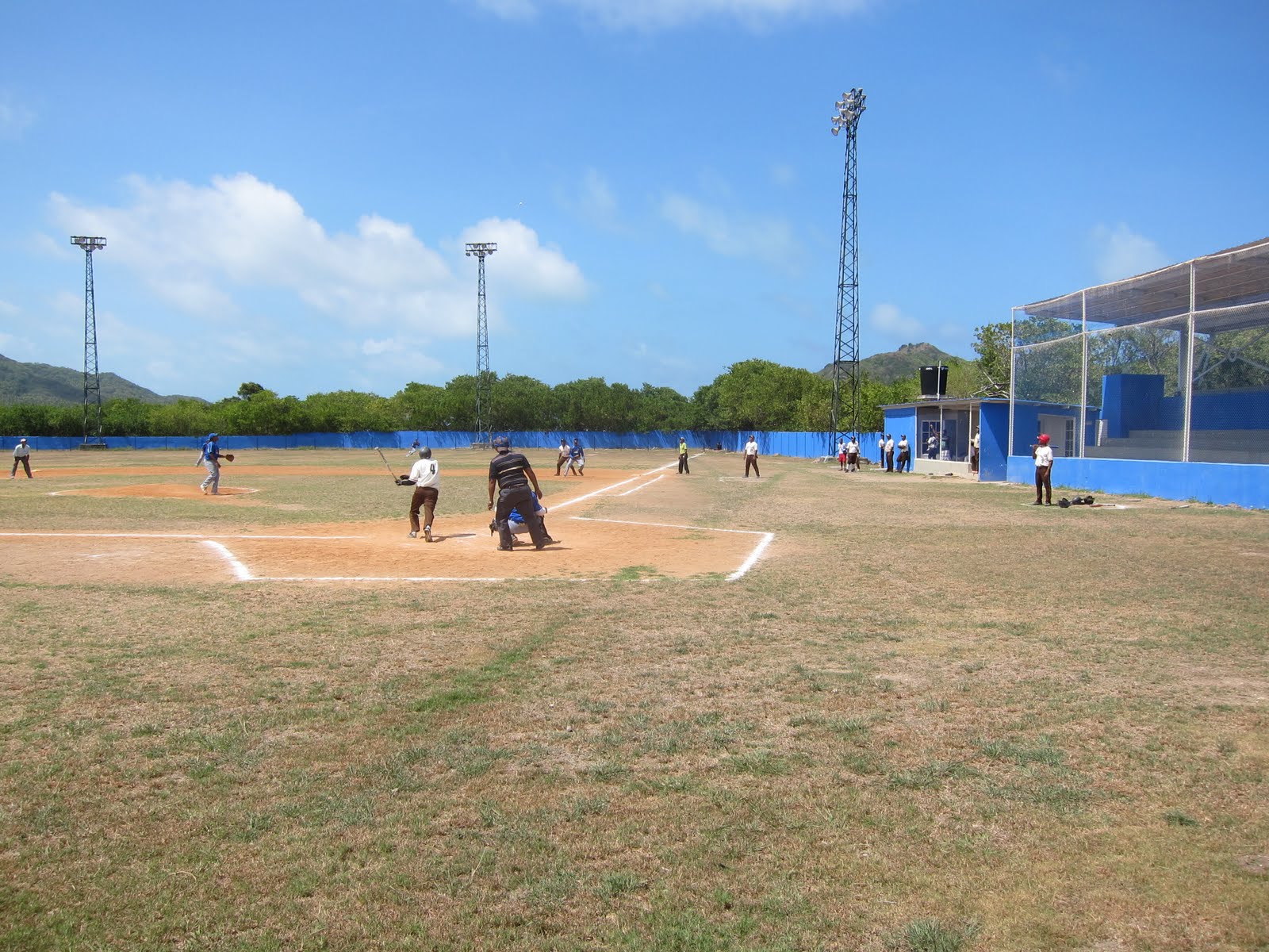
Here in Providencia one can do citified things like see a ball game.
I like the bikes outside. Providencia is about 12 miles long, there are a few trucks and cars and an occasional bus, but motos are the order of the day.

With new friends from Nilaya

Walking

I'll tell you what this is. It's a pig right on the path between dinghies and the main road

Other cruisers- Kamaloha with two children and two dogs aboard

Obviously a night scene in the town square

This sign says, STOP. Somewhere between April and July when it rains the traffic must all stop- the black crab comes down off the hills and if he or she makes it in one night, to the ocean, to deposit eggs and fertilize them

Here you see her eggs from

Front to back

No eggs

Help! They're everywhere- absolutely underfoot. We are walking the closed road with the owners of the Bamboo who want to show us this special event in their town.

More on the side of the road

We rent a motorscooter. There is one road through the island. Takes about three hours at most. We will pass by where we were crab watching in the night, but the crabs don't move in the day.


A beach restaurant- Roland's.
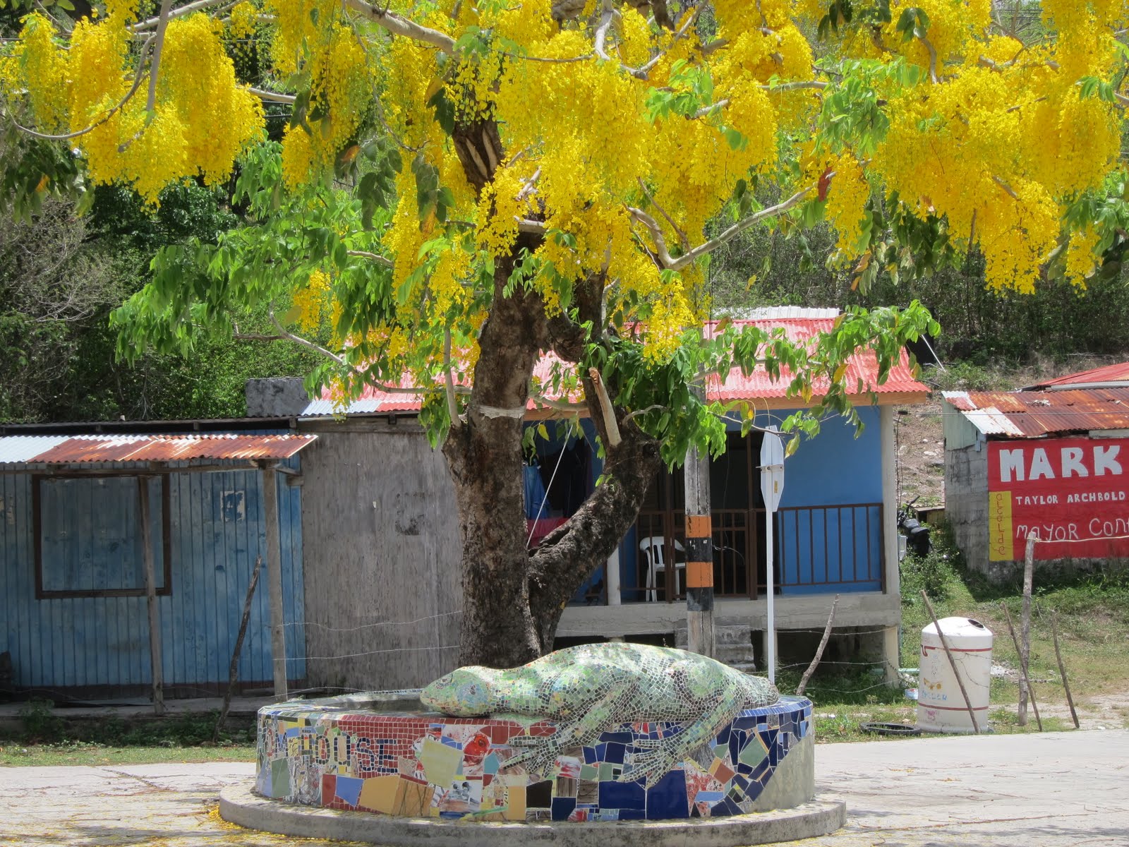
Sculpture to beautify a rather well- lived in part of town.

Rhhrummmmmm! On two wheels again.

Whoops-locals


Homes

A protest against Nicaragua selling oil rights.

school

resort on the beach

Beautiful beaches


Airy beach restaurant


water storage

A little one chatting with me. It's easy because most speak English

A park near a church


Whoa! That's a big iguana

A nautical theme


Soon we return the bike and are back in town at the town dock


Colombian soldiers

A very large octopus is entry to another park


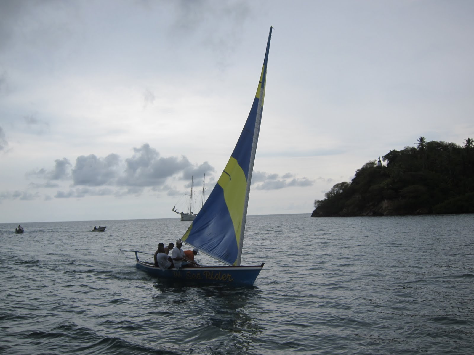


A race in the anchorage

m/v Eileen Farrell with nice people aboard. They took me snorkeling.

Mountains to climb

Morgan's Ass again. Morgan's head is on the other side of the harbor

Nilaya- they went to Panama.

We're sailing on to Cayos Cajones- The Hobbies- along with Kamaloha, a family from New Hampshire.

Yes, I know it's gross but I caught another Mahi mahi. Same size as the other, but a female. Took even longer to fillet and clean up, but well worth it because it freezes well. In June we arrived in Rio Dulce still with two meals of fish.

Arriving at the Hobbies. The lobster traps are piled high waiting for season.

We spent only three days at the Cayos Cajones, not a month as before. We thought of our other cruising friends we had so much fun with in 2010, Footloose, Valentina, Queen Mary and others who passed through and joined the fantastic music sessions that were so much a part of our trip, wondering what they were doing now. We visited the island and the caretaker there gave us fresh conch. We saw the Booby breeding area and Frigate birds on this tiny island.
Again, too soon, we move on. We are heading toward the Bay Islands of Honduras. Dan and I have made a decision to continue on to the Rio Dulce. We both like the area, inland travel possibilities and who knows when we might get this close again?
IT'S NOW MAY 28, 2012

