Saturday, August 27, 2011

UTAH- GRAND VISTAS and RED EARTH May 29- June 1, 2011


May 29- June 1, 2011
(Kanab, Zion National Park, Pipe Spring Monument, Toroweep GC)


We drove out of the Grand Canyon North Rim past the towns of Jacub Lake, and Fredonia using 89A through the Vermilion Cliffs and headed on toward UTAH. Our next park was to be Zion National Park in Utah. After the cold nights (low 40s) at the North Rim and camping through the Grand Canyon we were ready for a bit of comfort. We found a small, out of the way motel called the Sun and Sands Motel in the town of Kanab, checked the rooms for cleanliness and decided the price was right and what the heck we could stay two nights for the price of one. Not only was Sun and Sand affordable, but the friendly manager Wayne, was knowledgeable about the sights in the area.


After a bit of research, we realized there were many places we wanted to visit in UTAH. Utah has many areas and acres of land designated as National Parks. Confusingly the name usually has “canyon” in it, in fact we found Zion National Park was also referred to as Zion Canyon and contained an area called Kolab Canyon. Then there was Canyonlands National Park and Red Canyon, Moab, Arches, Natural Bridges….too many to name, much less figure out a route. Well, tomorrow’s plan would be Zion National Park.

ZION National Park


In Zion, park elevations range from 3600 to 8700 feet on the Colorado Plateau, and so provide many different habitats for many different critters; tiny pinon mice, golden eagles, mountain lions have their niches. As we heard at the Grand Canyon, there are Condors nesting above the canyons, as well as Peregrine Falcons. There are areas of Ponderosa pine, Aspin, cliffrose, a lovely pink bloom, and mesquite. The trailheads to the rim environment, into the canyons and along the Virgin River allow heartier humans to immerse themselves fully into the exploration. Zion’s special formations are water formed due to freeze, thaw multiple times over time and river erosion. Because parts of Zion have been used in the past for grazing and farming this park is not “pristine,” but still has a lot to offer.


We entered the park, with a short line of other cars, from rt. 89 and traveled rt. 9 to the East entrance. In Zion there is a 15 mile road heading north on which tourists (like us) take a free shuttle bus to visit the eight river-carved viewing areas through the bottom of the Zion Canyon. The canyon walls become higher and higher as the bus moves slowly to the Virgin River and the Narrows riverside walk.


Returning to the car and the main road, just outside the park road to the west, are restaurants, hotels, and gift shops selling native crafts and other souvenirs. We drove through the area, stopped and checked out the birds at a very nice town park rested on a picnic table for awhile and continued on another 80 miles on Indian land to Kolob Terrace Rd. to Lava Point and Blue Springs Reservoir where it was too muddy to 4x4) wanting to move away from the crowds.


It worked. We needed the 4x4, but the red, dirt road was well maintained. It passed through private farms outlined with fences and over cattle guards (metal road grates to prevent free-ranging cattle from leaving their usual area), high onto the plateau above Zion Canyon. We kept on on the private road and found the Blue Springs Reservoir where the locals fish, camp and cruise in small boats.


Here are some pics from Zion. These pictures are from Dan’s camera. My battery was dead; one of the drawbacks to camping.

Zion National Park


We were lucky to have our options in transportation. Sometimes we found too late that we shouldn’t take the bike to some of our destinations. Today, according to Wayne, was one of those times, we would be on dirt roads, so we headed to the Pipe Spring National Monument by car on rt.389 finding ourselves going through a time warp as well as a one hour time change and back in Arizona -on land managed by the Kaibab Band of Paiute Indians.

The visitors’ center was staffed by casually-dressed Paiute tribe members, as opposed to the usual green formal ranger gear we had become accustomed to. We absorbed information about the pre-Paiutes, the later Mormon settlers and the use of this important water source area as a frontier fort as well as a Mormon tith farm.


PIPE SPRING National Monument
Paraphrased from visitor literature

The area of the Arizona Strip, located between the Grand Canyon and Vermilion Cliffs has limited but important water resources. The groups known to have been located in this area were the Ancestral Puebloans until about 3000BC the Paiute Indians until the 1700s, when missionaries and explorers like Jacob Hamblin 1858 and John Wesley Powell in 1870 visited the area. Mormon settlers from Salt Lake City settled and farmed the area before and after that time. Water, the Spring, being crucial to the before friendly Indians, caused the Fort to be built in 1868 by the Mormon Militiamen. In 1870 Brigham Young and Anson Winsor paced off the new ranch that would be built as a tith ranch (at that time Mormon farmers gave 10% of their livestock to the church).


Later , about 1890, the Park Ranger guide in the “Winsor Castle” explained to our small group, how the wives and children of polygamists were often hidden from Federal Marshals to avoid testimony against their husbands.


By 1907 while the farm was still privately owned, the Paiute Reservation was formed around it. Water rights problems continued long after. The Paiutes could not find enough game to live and Mormon settlers all over Utah were displacing them from their traditional gathering and farming lands.


In 1916 the National Parks System formed. Steven Mather, the first National Park Administrator, saw the value in the Pipe Spring area as a rest spot for Americans who visited the Canyons Parks and acquired it for the National Park System. A railroad brought the tourists and In 1923 President Warren G. Harding signed the Proclamation to preserve Pipe Springs as a National Monument.
The story of acquisition of other National Areas with the laudable goal that these special “highlights” become part of the heritage of the United States seem to be similar to the issues at Pipe Spring. The road maps show reservation lands for the various Indian tribes. At the time the new land possession model must have been incomprehensible to the tribes involved.


As you enjoy the slideshow below, please pause to read the two views of “Land Management” that illustrate differences in philosophy between the two groups –Paiute and Mormon settlers led by Brigham Young- understandably causing tension.

Then we're back to the Grand Canyon-narrative below the slideshow

Kanab, UT, Toroweep Rd. to GC


In Kanab the next morning at the included breakfast, great coffee, bread, donuts and muffins and fruit, we met a couple who had taken the road to Toroweep, another access to the Grand Canyon, and raved about the 65mile trek in their Toyota Tacoma. Wayne also recommended we not move on without visiting Tuweep-the Indian name for the area. Well, why not, we agreed and off we drove, again in the Subaru.
Toroweep Road and back to the Grand Canyon ( the “less traveled” road..)


LOTS MORE UTAH TO COME!

Sunday, August 21, 2011

ARIZONA May 13-29, 2011: Cactus, Coyotes and Canyons

(Arizona canyons, to Grand Canyon National Park)
BIRD WATCHING IN THE CANYONS

Leaving Texas behind, we drove/biked into ARIZONA.   We chose to use
 rte 10, hoping to be visiting the canyons in the southeast during the spring bird migrations, as VENT (Victor Emmanual Nature Tours, does.  There is a great website for birding in Arizona and we used it to plan our trip for the birds and scenery available in the southeast canyons and mountains. www.sabo.org (Southern Arizona Bird Observatory)

Some places we explored were Miller Canyon with its hummingbird feeders at a private home, that allowed us to view perhaps six or seven species at once.  There was Carr Canyon,where we 4X4ed to the fabulous Ponderosa Pine campground on the top spotting our first Stellar Jay , Sawmill Canyon where we  hiked and located the Elegant Trogan and saw a Painted Redstart in display.  At Garden Canyon and Fort Huachuca there were Pronghorns, Mule deer and trees dripping with beautiful Western Tanagers.  Check the pics of some very dangerously placed Pronghorn Antelope. (see slideshow below)

CHIRICAHUA
Dan knew that, unfortunately, Arizona Chiricahua region was engulfed in a fire that did not allow travel to Portal, a famous birding spot we had planned on visiting.  In the Sawmill Canyon we met some birders with their guide, and the guide told us that it was still possible to see another part of the Chiricahuas entering from the west.  That was good news so we prepared to take that trip.

Along the road towards the Chiricauas is Ariavaipa Canyon Road and some other scenic but unpaved roads.   The bike went back on the trailer we bounced our way along the rutted dirt road through private ranch lands into the canyon. A good sighting there were the Common Black hawks in their nest in a tall tree in an orchard.  We drove down the canyon to the trailhead as far as we dared, then returned back to the main road and travelled on.  An unexpected surprise was the beauty of the Chiricahua National Monument park area where we marveled at the unbelievable rock formations towering above us and the surrounding mountains. While walking, we saw a Western bluebird up at Rustler Campground and when birding above 7000ft. Dan was lucky enough to spot***

 As we drove the Chiricahua Mts from the western side we saw and smelled the raging fire in the distance. A Ranger in a pickup truck approached us and said that the road would be closing if the fire continued to spread with the wind in our direction.  I was all for turning around right then but Dan wanted to go on further and felt we had plenty of time before the road would close.  We continued on for quite a way but found we could drive only as far as the town of Paradise, where amazingly, just as we needed to turn around because the road up ahead was closed we found George Walker House, a private home and B&B with multiple birdfeeders drawing in the local birds active in their yard.  We were invited to stop and have a soda and watch the feeders before heading back over the mountain the way we had come.  They were very welcoming and we were glad for the rest.  At the feeders we saw Lazuli Buntings, Mexican and Scrub Jays, Black headed Grosbeaks, Acorn Woodpecker and more.  We then turned back over the mountain. 

We were able to stay at our campsite another night without mishap and the next day continued our journey toward Tuscon.  The Monument National Park terrain was forest.  We now headed to lower elevations and the desert plants similar to those we had seen in Texas.  I say similar because we were now in the area of Saguaro cactus, a plant often as tall as a one story house with a diameter on its one stalk of twelve to fourteen inches, very impressive and vaugely familiar from cowboy or Mexican movie scenery.

Just north of Tuscon, Dan found a road on the map to ride and so up and around the smooth corners we went.  The overlooks provided a great view of the city and surrounding areas.  This road was also used by bicyclists who chugged their way up Mt. Lemmon and went screaming down.

ARIZONA-SONORA DESERT MUSEUM
A very special place we visited in Arizina near Tuscon was the Sonora Desert Museum.  The museum grounds contained and displayed well kept growing specimens of hundreds of varieties of desert plants.  The natural settings provided a non-zoo-like atmosphere to see live desert creatures; mountain lions, bobcats, the wolves, coyotes, a bear, javelina, lizards, snakes and small ground animals.  A special touch was the exquiste, lifelike bronzes of those same animals in natural poses.  The bronzes were so well done they enhanced the exhibit especially if the real animal was hard to spot. Very educational.

As we entered, a volunteer was holding a Harris Hawk and explained where they live and how they hunt, sometimes in groups.  We spent quite some time listening to lectures on the plants oand their historical uses in the desert and then went into the aviary where many species of birds from songbirds to hummingbirds to doves , quail and ducks were pearched, flying, standing or walking often within a few feet of the path and easy to spot from the many shaded benches.

 We camped near the museum at a close to deserted campground. We camped near a couple we had met in Sawmill Canyon. They had been hiking and shooting pictures with a local bird guide then, and the man was talking about a shoot he would do later with the snakes and reptiles at the guide's home. I wish I could have seen that! We again met at the museum and they again put their super lenses to good use photographing birds and animals. It was unexpected and fun to meet up with them again.

Soon we continued our trip north to Flagstaff to visit the South Rim of the Grand Canyon National Park.

HEBER BMW RALLEY

We travelled over the winding rte. 77 over the Pinal Mts. to the town of Globe, where we met a fellow BMW biker who was on his way to the town of Heber and a ralley.  A BMW ralley- that could be fun, so we headed off through the White Mountain Apache land toward Overguard and Heber.  The weekend was fun, but very cold.  We had to wear most of the layers we had brought while we ate hot chili and cornbread in the open fronted building, and it was good.  Of all the crazy entertainments, the organizers have a history of inviting belly-dancers to entertain!  We watched for awhile as the beautiful young ladies gyrated up and down the aisles, barefoot on the concrete floors wearing flowing, lightweight, minimal gowns.  We enjoyed our time there and met one biker that we later ran into again in Grand Canyon Park.

Leaving Heber toward Payson on rte 260, our next stop was after the tourist town of Sedona, one of the upper mountain campsites, then on through Flagstaff in the morning and onto the road to Tusayon, the south entry to the Grand Canyon National Park.

GRAND CANYON NATIONAL PARK

Our guidebook said "the Grand Canyon, sculpted by the Colorado River is over 277 miles long, and Americas number one natural wonder.  A vast panorama of pyramidal buttes, loney mesas, rust colored cliffs and shadowy side canyons.  It's ten miles from the South Rim Village to North Rim Lodge.  Scientists estimate the canyon is relatively young at 5 to 6 million years old but the rock layers at the bottom date back some 2 billion years and the rock on th rim where you stand is from the 270 million year old Permian period."

The guidebooks and pamphlets taught bits and pieces of the science. Speaking about the age of our Earth, for me is impossible because time on the geologic scale is incomprehensible.  I can recall my High School studies on the forces and results: volcano, eruption, water flowing, erosion, cold temperatures and freezing/thawing cracks and fissures- but in gazing into the canyons, how rocks "land" the way they do and the stratas in the canyons seen on this trip, were more of a visual feast; beauty, starkness, grandure, shape or color than understandable to this humble human.  I think the early Indians and the settlers of the mesas and valleys did fine without intellectualizing their piece of the Earth.  So although I stood and dutifully read the helpful geologic information I remained boggled, and kept returning my eyes and attention unconsciously to the sight before me.

After the Grand Canyon we headed into UTAH.

Dan and I hope the reader will enjoy our pictures.  The names of the canyons and overlooks are available in the on-line maps of the parks. Again, if there are errors in identification I apologise.

There are pictures in this slide show of Arizona.  Enjoy! 124 pictures. The canyon shots are improved by using the + viewer on your browser.

Arizona's Desert, Sonora Desert Museum, Vermilian Cliffs, Grand Canyon S+N


Now the BMW Ralley May 19th and 20th, 2011

Beemer Rally


Saturday, August 20, 2011

APRIL 19, 2011 The West Tour Begins :Go West Baby Boomer!

PLANNING to Land Cruise
(Texas to Carlsbad Canyons)

FLORIDA
Usually, when a cruiser couple ties up on land, perhaps puts a "For Sale" sign on the boat aand begins to drag their personal effects off by the duffel-bag load it is called "burying the anchor." It usually happens after a great deal of soul searching and agonized decision making as well as a plan for the next steps --on land.


For us, Dan and Kathy, the owners of IPY440 hull 16 named Sea Star we simply took a vacation from sea travel after close to three years. We tied up in Titusville, FL and planned a land trip. Neither of us had seen the United States west of New York except for drive throughs so we decided to visit some of the National Parks in the West and into Canada. Dan's dream also included getting back into motorcycling after quite a number of years without riding a bike. We thought about that for a long while and bought a R1200RT BMW and began to ride again in Florida. To brush up on skills he took a driving class. That worked out well, we were both excited about riding, so we started equiping the bike for the long haul we were planning to take.

We decided that we had been tent campers when younger and anyway only a tent would do for a motorcycle trip so by purchasing the latest and greatest new lightweight equipment, we would be good to go. After all, we both had become addicted to internet motorcycle forums like BMW Owners and Adventure Rider so we were thinking -just bungee on the equipment and ride away.


For us, things didn't pan out like that. The piles on the boat floor were growing as we read about the absolutely needed equipment. I think the final straw was the strong suggestion that to enter the Western parks, a minimum of five gallons of fresh water and ice would be needed. How do you carry a five gallon igloo cooler on a motorcycle? We thought-maybe we need another option.

We had recently bought a Subaru Forester All Wheel Drive vehicle to get around the dock and to the East coast. We had a trailer hitch put on, fit a light-weight Aluma trailer to carry the bike, loaded up the car to the ceiling with all the carefully selected gear, oh so carefully strapped the bike down, and drove off in the car to the Texas Hill Country.

THE INFORMATION ON THIS TRAVEL BLOG IS TO THE BEST OF MY RECOLLECTION AND DEPENDENT ON WHAT RESOURCE MATERIAL I KEPT OVER THE THREE MONTHS. IF THERE ARE GLARING INACCURACIES PLEASE LET ME KNOW. I ESPECIALLY APOLOGISE TO OTHER BIRDERS FOR NOT INCLUDING ALL OUR MAJOR SIGHTINGS WITH SPECIFIC LOCATION.

Also, I've upped the resolution on my photo uploads.  They will probably take a few more seconds to load, and for captions to appear.  If you can't see the pictures clearly, press pause and allow a bit of time for photos to load.
Sometimes after 50 pictures a new page appears.

TEXAS HILL COUNTRY

Dan felt it was important to beat the heat in the West, and it took us awhile in Florida, longer than we had hoped, to begin the trip. We arrived at Neils Lodges on the Rio Frio in just two days. There Dan removed the bike, started riding in this area known for great motorcycling and never looked back.

Riding and birdwatching were our main pursuits for about a week as we walked on back roads at Las Maples along the Rio Frio and open fields in quest of the Black -capped Vireo, a secretative bird with a distictive call, which we never did see, but heard. I've try to recreate our list here. The blackboads in the pics were posted at Las Maples. We were told stories of where the elusive Colima Warbler was recently located at Big Bend National Park, and watched the nightly show of birds at the drip spout on Neil's property.

One evening after reading a description of the event we joined a small group at the entrance to a private road
for the nightly Frio Bat Cave display, which was amazing! Three million, we were informed, Mexican freetail bats pour from a small opening in a cave to feed, and return by morning. In the bats' emergence from the cave the predators such as Red tailed hawks and Perigrin Falcons have learned to stalk their dinner of juicy bat. Here are some pics (slideshow) around Texas Hill Country and video of the bat extravaganza.

April 25- Texas Hill Country

NOW TO TEXAS BIG BEND

Great start we thought, and next we were off to Big Bend National Park by way of Marathon, TX., me in the car with the trailer and Dan on the Beemer. We usually met up a few times during the traveling day at rest stops or for lunch. I got pretty good at catching a glimpse of his neon green jacket and making the stop. I had to learn to find places long enough to park and turn with the trailer but since RV's and much larger trailers abound out west it was doable almost every time.

I had been following a blog of the local Big Bend area birds written by employees at Marathon Trailer Park. We talked to Heidi and Matt, set up our new Nemo 3 person tent for the first time and spent a few days around Marathon, specifically the Post Park,at Matt's suggestion, before heading on to Big Bend. We entered at Panther Junction, Dan on bike and me with car, trailer and the five gallon container filled with ice. We carried lots of water, and some food.

Our eyes simply popped out of our heads at the canyon scenery along the way and, sooo different from New England. Soon we arrived at Rio Grande Village, selected our campsite from many, ours had a concrete pad with roof over a solid picnic table, and a soft spot under Cottonwood trees for a tent. We were home for the next few days.

Near the campsite was a five foot by three foot deep metal box with front opening doors, our first introduction to "the bear box", designed to keep food and gear from attracting unwanted visits from hungry bears, and another animal new to us, the Javelina. The Javelina, or peccary, looks like a wild pig, has tusks and dainty, little feet but can be a worse nuisance than a bear. Lots more birds and animals came onto the list, like the Golden-fronted Woodpecker that landed in my still warm from eggs frying pan, Roadrunners, huge Jack rabbits, cottontails, deer and coyote.

Daily we rode the paved roads exploring on the bike but we used the car a bit, too. Big Bend has many marked and maintained 4X4 roads that we could explore. We bumped a loong 4 wheel drive to Pipe Springs, learning what our car could do,(or not do with its ground clearance) and had a few special days of zooming around on the BMW staying on the pavement as it was pretty dusty, not to mention windy. We never did track down the Colima Warbler there in the park.

One evening and night at the campsite the wind came up suddenly and became very frightening to us as it swirled every which way, kicking up dirt and throwing branches at our little tent home. We couldn't cook and that night we stayed in the car trying to sleep as the noise of the wind rose and fell, thinking about the large branches of the Cottonwood OVER our tent. In the morning the park service had small bulldozers removing debris from the camp!

In a few days and after a wonderful, twisty ride to Santa Elena Canyon on the bike, we picked up the tent and gear and headed toward another part of Big Bend, the Chisos Basin Campground. We we fortunate to meet two other couples riding BMW's and had a few fun evenings sharing stories and places to "not miss." Dan and I admired the other folks ability to have all their needs on their bikes. (By that time we had learned that ALL the parks have running water available at what they designate as 'developed' campsites (like where we camped.) Developed sites also usually have flush or pit toilets-no showers but in Big Bend showers were available at the General Store for a small fee. The General Stores in Big Bend are concessions and sell many camping necessities, blankets, tents, pegs. They also stock water, ice, beer, wine and limited food supplies.)

Here are pics from Big Bend. Enjoy the slide show. It might take a bit to load the 80 pictures.

Texas 4 BIG BEND-Guadelupe CarlsbadCavern


After Big Bend we planned a route towards Arizona by way of Davis Mts, where we actually saw the destruction and blackening caused by the recent fire there. The wildfire had burned more than 300,000 acres and threatened the McDonald Observatory which reopened by the time we arrived, so we were treated to a night of exploring the Texas skys on their smaller telescopes. The larger telescopes had been removed for their safety and were not available to the public yet.

To our surprise we met the same couple riding a Beemer whom we had seen at Big Bend at a campsite in the Guadalupe Mountains. The next day we decided to take a day motorcycle trip with them to NEW MEXICO and the Carlsbad Canyons, only about 40 miles. The day was great, a litttle windy, but the Caverns were magical. We walked over a mile and a half into the mountain on concrete walkways. Then, we were expected to take the elevator out because of the time we entered. Well, OK!


ARIZONA Mid May 2011- next log section.

There are dots on the map in the Western states to illustrate the route of our trip.  To access the correct spot on the map, use the left and arrow up or down buttons to find the orange dots.

Tuesday, April 12, 2011

TITUSVILLE MUNICIPAL MARINA and BUSY February – April 14, 2011

TITUSVILLE MUNICIPAL MARINA and BUSY February – April 14, 2011


Titusville continues to hold lots of possibilities for exciting and full days! The marina has already proven itself a safe place for Sea Star when while we were away during a thunderstorm a few wind gusts of 74 knots blew through without mishap. It was because of our dockmates that no harm came to our boat. Titusville Municipal has great staff and friendly cruisers, and those like us who have cruised some (or even for years) and have decided to stop for awhile.


So what has changed since I last reported on February 14th after Bonaire? Well, we are doing a bit of driving in our all-wheel drive Subaru. Two trips to New England; one to visit and the other…. I’ll get into THE SECOND TRIP soon enough.

Merritt Island Reserve

Beside the long trips we needed to take to New England, it’s great to have a non-water vehicle again and drive to the grocery store or to the hardware store, never getting lost because of the car GPS unit. One of the exceptional places we can drive to is Merritt Island Wildlife Reserve, a short five miles away where we are like little kids, agog at seeing alligators, their shiny scales, long, swishing tails, and very beady eyes ominously appearing many times when we’ve stopped to use our binoculars to achieve a better view of some new to us birds. In the Reserve we can usually see a Bald Eagle high on its nest on a radio tower, Scrub Jays, an endangered species quite lovely with subtle blue feathers, many shore birds and ducks; Plovers, Grebes and four varieties of Herons; Great blue, Little blue, Green, Tricolored all available on excellent paved roads – without going more than twenty feet from the car unless we want to. I walked up the road only twenty feet to grab these poor pictures of Roseate Spoonbills. I wish you could see all of the birds through binoculars- some pics of Jays and alligators didn't come out at all so I can't post them.


The spotting of shore birds is very easy, low Florida scrubby bushes, no trees to get in the way when checking the banks of canals for what they may provide, or scanning wide open grassy marshes for the hawks or harriers swooping or riding the air currents. There are many sightings of Bobcat reported in the park, although the Reserve closing at 5:00PM makes seeing these elusive creatures difficult. We have not.

THE SPACE PROGRAM IS ENDING

Titusville is on what is called “The Space Coast”, obviously because of Cape Canaveral and the part of the US Space Program at Kennedy Space Center involving the Space Shuttle located on the same island I just described! The two times we witnessed rockets being launched from Cape Kennedy the importance to the community and entertainment value of the launches were obvious. The volunteers at the Reserve suggest the wild life and the rocketships can co-exist just fine.


The morning Sea Star was to enter the marina back in November, Dan looked up into the sky while I was pulling in our anchor because he saw people pointing and he heard voices from the boats anchored around us. We saw a small trail of smoke growing larger in the early morning sky until what was a rocket had loudly boomed a few times, then trailing the launch signature white, puffy smoke, the sight mesmerized us until it disappeared and the smoke evaporated slowly. A pretty spectacular Florida arrival, we thought at the time after our long, cold slog up the coast from Key West after crossing from Isla Mujeres on Thanksgiving Day.


Another evening just at sunset we and others were sitting outside on the bows of our boats when an even more impressive rocket was launched into orbit. We certainly watched and listened but we had already been spoiled when we saw Discovery launched a few weeks earlier.

The largest extravaganza was when Discovery was being sent to the Soyuz Space Station. That was an incredible local event with people invading the area from all around filling the hotels and restaurants, some crowding to line up along the pedestrian walkway of the newly opened Space Bridge (adding a new 66 foot bridge for travelers on the Intracoastal Waterway) to gawk at the trailing smoke, hear the massive engines roar to life and feel the vibration from the huge booster rockets as the staging fell and Discovery was off for the very last time. There was a 20 minute delay, but basically all went as planned. The crowds yelled, clapped and partied ‘til late all around town. We boaters had almost “the best seats in the house”. From the comfort of our own lawn chairs on the decks, we could enjoy the spectacle.

ECONOMIC ISSUES IN FL

All is not well in the Titusville area and the Space Coast. I’ve heard over the past months and especially now, thousands of space employees are losing their jobs as the Space Shuttle completes its last launch in April. The devastated economy is seen in the amount of Real Estate that is available with prices already low. Homes, condominiums and businesses are for sale with no prospects. Obviously this is the “coffee shop” talk all around us. Dan went for a haircut and the barber was moaning about his business dropping, “fewer haircuts and nobody gets a shave.” Apparently some private corporations are coming into the area, one aircraft builder, I think from Brazil, that may be able to employ a few of the highly trained workforce, but many will pack up and move to where ever there are jobs. There are not many jobs in Florida with its 8% unemployment figures.


In walking distance from our boats are local parks. Nice places for the tourists and locals to enjoy the Florida sunshine. Dog runs, ball fields and climbing structures are provided. Last weekend there was the Indian River Festival at the park nearest our marina. I guess it was like a mini fair with rides, events like bull riding and go-cart races; just a nice family event.

Daily Florida temperatures have risen since our arrival back and today and yesterday I felt like I was in Guatemala with temperatures reaching the 90’s! Beaches are open. We haven’t gone swimming yet as the locals say the water is too cold but it’s no colder than the best days at Block Island, RI in the heat of the New England summer, so basically it’s very confusing. What do I get up and put on in the morning? Right now it's cool at night, very cool early morning then the sun starts to beat in on the hatches so we close them and go onto air conditioning about 2:00Pm if we're about the boat. We broil til about 6:00PM and then it's often very cool by bedtime, 10:00PM or so. Bugs have not been bad but I hear they may get worse soon.

DAN’S NEW ADVENTURE

Our SECOND trip to New England was planned around two things. Dan had a specific day for continuing education for a contractor license and we went to AJ’s Cycle shop to pick up our new BMW motorcycle, that was ready for us March 26th.


Somewhere out in Panama, Dan started thinking about how much he missed riding on a cycle; the wide open feel and surroundings, as well as the need for speed after Sea Star’s average 6knots with just a little acceleration in wind gusts! He wanted to ride again, and I agreed, as I had not yet seen any of the western US and friends told us we were missing a lot. For this adventure, we needed to return to the United States and find a safe place for Sea Star as she is our moving home base.


So here we are in Florida now with the new bike after trailering it here from New England. Our plan includes a visit to Texas, probably to Big Bend National Park. We will drive out on route 10, trailering the bike and see where we decide to explore. We’ve read about some VENT birding tours that travel to where we’d like to go, so we will include our interest in birding along with the renewed motorcycling experience. We have light weight gear for camping and we’ll try that again, too. Here we will be in the middle of RV land, but on the ground. Unless we choose to use a hotel for greater comfort sometimes.


The last few months have been spent “gearing up” and the last few weeks practicing the riding; first, no gear on the bike- just Dan, then add Me and get used to cornering and stopping/starting with the extra weight. Next we added the side saddle bags and made our two helmets connected so we can speak with eachother and Dan can hear the GPS traveling directions. Soon we’ll add the top rear case, which we need for “stuff” because I have no interest in a bike of my own so that we could carry even more gear.


It’s exhilarating to ride again. Here the roads are open and straight unless you look for the “twisties” or “sweepers”. It’s been 31 years, however, so we are conscientiously practicing starts, quick stops, U turns and “wigglies”, like S curves. Dan even took a class to refresh his riding skills and said he learned a lot of tricks to improve his riding.


Dan and I are connected by an intercom in our helmets, guided by GPS and entertained, (should we care to use it while driving) with FM radio, Sirius radio or Ipod, so there has been a bit of learning curve on those items, too. Today we spent two hours on the phone straightening the intercom issues out and downloading new software for our Scala Rider Power sets. Very high tech but wearing full face shields, we really can't just holler to each other. We've read a lot and despite the lax helmet rules in Florida (many wear NO helmet, just a tee shirt and many girl passengers are seen in fip flops) Dan and I will wear full protective gear.


Dan and I keep up with the blogs of friends we met cruising. We hope to keep hearing their news and about the exciting places they are roaming. We miss Braveheart (now off their boat) on newly purchased farm land in West Virginia, Tregoning on their way by Morgan sailboat to Hawaii after just leaving the Galapagos Islands, Windsong living and climbing in Korea while teaching there, friends living and playing in the Bay Islands of Honduras, Cormorant maybe still in Italy, so it goes on.

Soon we’ll be on our way again too -and our sailing blog will become a trip report like other motorcyclists write, if and when there is time and internet.

Enjoy the three types of pictures: Around the marina, family visiting and the new BMW, and the long trip back to Florida.

Around Titusville Marina

Tuesday, February 22, 2011

Christmas away- then Titusville to Bonaire Jan.12-Feb.14, 2011

Dan and I left Sea Star at Titusville Municipal Marina and headed home to MA for Christmas and New Years with family. After so much time away from them all, it was a wonderful but short visit!

 While there we visited friends, refreshed our memories about snow and cold, visited our doctors and drove back to Florida to begin our next adventure.  We had been asked to house sit and take care of a sweet little cat for ex-cruising friends on the small Dutch Island of Bonaire while they traveled.  Lucky us!  The home was gorgeous with great views from the patio and swimming pool and cooling breezes off the ocean throughout the night.

Here is a picture of the kitty!
From Bandit
HEY MOM AND DAD,
I'M HAVING A PARTY!
LOVE, BANDIT


Bonaire is the "B" of the A, B, C islands about 60 miles from Venezuela.  The others are Aruba and Curacaio.

Bonaire is well known for its excellent scuba diving.  The diving has been listed as "Best" in many catagories in Scuba Magazine for over five years although diving opened in Bonaire many years ago when "windows" to the reefs were opened from many different sites from the shore.

Dan and I, and our visitors enjoyed our water time out of the pool by snorkeling many shore sites. Red Beryl, Andrea, Tolo, 1000 Steps are some famous names. Reef fish such as huge Parrot Fish, French Angels, and so many others I can't list them, along with octopus, Moray Eels of many types and sea turtles were easily seen. We really didn't even have time to consider grabbing a boat to Klein Bonaire, a smaller uninhabited island ringed with reef.


 In the month we stayed in Bonaire we explored any drivable road on the 30 mile long island, went into and around the Washington Slagbaai Park by rental truck and had an incredible time. We watched flamengos and saw areas where the ancient Indian tribes inscribed pictorial language.

Here are some tourist- type pictures. The water is a fantastic color of blue with shallows green-blue.  Corals show somewhat brown from the surface. Although we saw herds up to fifty of the wild free ranging goats, I didn't take a picture, darn.

click for slide show

visitors Bonaire


Bonaire is a very dry island, and the temperatures are very warm.  While we were there the day temperature was 84 degrees with water temperature about 80 degrees on the surface where we snorkeled. The landscape often shows trees bent by the wind, underfoot are sharp and deadly coral rocks.  The early Europeans brought goats and donkeys to the island where their decendants still roam freely.  To protect themselves the low, scrubby bushes, trees and shrubs these introduced animals constantly feed on have developed deadly weapons, THORNS, which my pictures will show you.  Thorns make it difficult for people living on the island.  One problem they have and we had to watch out for, is flat tires due to the thorns that grow on bushes but fall to the ground- sticking in the tires.  Like a nail in a tire, when the thorns are removed the tires lose air.

Enjoy these Bonaire pictures  These are the ones that try to show the difficulty for animals, birds and people to live on these islands.  My own collection of Bonaire thorniness!  Not only do thorns and cutting coral rubble liven up the landscape but follow the wiki link to see the deadly tree.  You can't touch it, eat the fruit Or stand under it in the rain.  The result can be skin blistering!

click for slide show
Thorns


http://upload.wikimedia.org/wikipedia/commons/9/92/Hippomane_mancinella_%28fruit%29.jpg


To all our friends and Blog readers.  Dan and I are no longer international.  We're back in Florida with Sea Star but will be heading out on a new adventure probably in the Western USA by motorcycle as soon as Dan picks up a new BMW.  We are not selling Sea Star, just doing something else we want to try. We love to hear from our cruising friends and hope you will continue to email and contact us!

Monday, November 29, 2010

Key West to Lake Worth - Intra Coastal to Titusville, FL Dec. 4-8, 2010

Key West was definately the United States.  There were exciting things on the shelves of markets like the right size screws, aselection of tools, cleaning supplies for the boat that had been unavailable, and of course a real marina with electricity and clean water.  Best of all I hadn't seen a laundromat since....?

The crews of Braveheart, Mystic Moon and Sea Star had a wonderful dinner in town and stopped to play pool at a local watering hole before returning to our boats for the evening.  In the morning we met at famous Pepe's for breakfast--so in between the nine hour days of work on Sea Star we had fun.

Key West was not very busy in December but I could see the attraction when the weather was better in the outlying islands and reefs.  Everybody has a boat, or charters a boat for sailing, fishing, diving and zooming around.

After our boat was ready and tested, Dan and I moved out of the expensive marina and picked up a town mooring.  Bad idea! It was windy and the moorings were on short lines.  They did not provide a bridle for your boat and there did not seem to be a way to slip a line from the boat through the tiny loop at the top of the mooring ball.  Each time I tried something dreadful happened; first I bent the brand new boatpole and dropped it into the water(luckily it floats a bit and we got it back), then I lost the old boatpole as it was pulled out of my hands as I tried to capture the mooring ball-- finally a nice man, a cruiser, arrived through the surf in hid tiny dinghy and put the line through the loop for us.

Key West web


The next day we left the mooring field, without paying as noboby came out to us and we weren't going to put the dinghy down, thinking we would meet uo with Jimmy and Donna on Blue Water Cat in Marathon, Florida- one of the anchorages in the Keys.

Conditions were right to keep on going rather than stop, to beat an approaching cold front.  We were quite anxious by now to arrive at Titusville, some 350 miles away.  We sailed the Hawk Channel, avoiding the many crab pots during the day and just hoping to miss them at night as we moved along for all day and night.  By 2:00AM we were crossing Governer's Cut where the big guys play.

We were surrounded by cruise ships, tankers, and all manner of boats wating to go into Miami.  Sometime in the afternoon we were approaching our goal; the Lake Worth Inlet where we had crossed to the Bahamas from on Thanksgiving of 2008, our first year cruising.   Our arrival at the inlet was just in time.  The front had arrived, roiling the sea and the winds were increasing as we passed through that narrow cut and into the much calmer water within.

The anchorage in Fort Worth was fine for us, but others had run aground getting in there.  Tow Boat US basically was sitting in the anchorage entrance and just waiting like a vulture.  We were able to get some sleep before starting off again at 6:00AM.  Dan had decided that the rest of the trip would be "on the inside" meaning in the Intracoastal Waterway.  The weather was just too cold and windy for another day in the Atlantic.

In the Intracoastal there is always a lot to watch out for so it isn't relaxing at all.  We knew we would have to go under many bridges per day and that movement had to be timed to the bridge's schedule. Our mast is 63 1/2 feet and the most clearance you get is 64 feet on the fixed bridges.  Some areas of the ICW are shallow, or the waters are contained in a channel and a passing motorboat might "wake" you with a tidal wave sized plume of water, and it was Saturday and many boaters were out.  Oh, and did I say it was cold? The temps went into the 40's at night.

One full, long day mostly hand steering from 6:00AM to 6:30PM brought us to Vero Beach Mooring Field, where we rafted up as required with another boat.  Jim was a new cruiser but he had the idea.  As we tied up to his mooring he asked if we wanted some Jerk Chicken!  Totally yummy.  We had a few beers with him and collapsed, waking to start out again at daylight.

The ICW can be lovely.  There is wilderness, some of the lovliest homes in Florida, animals, birds, Manatee if you are lucky and many many red and green markers to go between in the dredged channel.  The trip would have been more enjoyable had the temperature been warmer.  Dan who was driving couldn't get or stay warm.  Check out his pictures wearing everything we had on board.

cold


By dark we were still pushing on toward Titusville.  We went through the last two bridges in the pitch dark and anchored outside the marina for the night.  There were as many as twenty cruising boats in the anchorage and it was soo cold!

That night as we were anchoring there was a huge noise and we were thrilled to watch a rocket take off from the Space Center and shoot brilliantly into the darkness.  We slept well knowing we we basically there and could begin to plan to drive home after we picked up our new car waiting in Tampa. We worried a bit about Patti and Gary who left the Rio a week after we did.  Their weather was really rotton and they were heading to Titusville, too.  We had left Braveheart in Key West at the marina for the military and Mystic was preparing to leave their boat for Christmas, too.

In the morning we tied Sea Star to her new home and prepared to be landlubbers for awhile.

Saturday, November 27, 2010

BACK IN THE USA! ISLA MUJERES to KEY WEST Nov.24-27, 2010

Landfall USA

But first:
Enjoy a few shots of Mexico's Isla Mujeres or Island of the Women.  Holly, Kathleen and I did some sightseeing by golfcart where, from the back facing seat I took most of these shots.

Isla Mujeres web


Sea Star and Braveheart set off sailing from Isla Mujeres, Mexico on 6:00AM Thanksgiving morning to begin our expected 40 to 44 hour passage across the Yucatan Channel and the Gulf Stream. To be determined by weather was whether our first landfall would be the Dry Tortugas National Park at Fort Jefferson, or the funky islands off Florida’s Southern extreme, Key West. If we chose the Dry Tortugas we would be taking a slightly shorter route to land, but landing in a more remote location. Dry Tortugas is well known because, as it a park, no spear fishing is allowed within the park boundaries but the snorkeling is superb. If we chose Key West we would continue to travel for about 80 miles more, would miss the stop at Tortugas but we would truly be back in the USA. We could complete the necessary clear-in procedures and visit restaurants we both remembered from previous visits.  Something I as cook was looking forward to.


By 7:00 AM Sea Star was motor-sailing along at about 7 knots in six foot seas with swell from the East and winds of 20 to 22 knots. We made our way out of the harbor and flats that protect Isla Mujeres and finally over the shallow bar entering the deeper channel and the way out to the Yucatan Channel and the expected current boost we hoped would help us travel in a northeasterly direction.  We had plotted a few waypoints to hopefully take advantage of an expected .5 to 2.5 knot northerly, then northwest current, expected to improve our speed through the water toward the tiny islands either 270 nautical miles to the Dry Tortugas or 350 miles to Key West.


For the first thirty miles we bounced along, popping in and out of deep troughs with water cascading down both side decks, sailing along with staysail and main. The forecast was for the wind to slowly abate and become a comfortable 15-20 knots by mid afternoon. We were able to add the jib and we sailed along with the benefit of 1 knot of current. By the end of sixty miles and 10 hours the seas had subsided a bit. We heard the weather report from our new cruising friends on the Selene trawler, Mystic Moon. They mentioned that Chris Parker, our weather guru, warned of a period of higher winds coming quite soon, so Chris thought it best that Mystic forgo the stop at Dry Tortugas and move right on toward Key West, so by Saturday afternoon they would be in port. From then on our course was set toward Key West. Mystic Moon, a beautiful 45 foot Selene Trawler set out from Isla Mujeres about eight hours behind us.


Dan and I relaxed as the wind slowed a bit, reefed the main and jib for night sailing, checked the current and continued on through the night with about two hour shifts on watch. We saw a few targets on the AIS system but they were not too near. That night was warm, the stars were brightly lit overhead, and the moon was close to full. We could see the tricolor light of our buddy boat, Braveheart, with Holly and Jack and their dog, Charlie, aboard. We had radio contacts with the two other boats on schedule and we all were moving well.


Moving well means we were traveling along on course, the boat was acting correctly because there was enough wind to sail a course, but neither of us had to touch the wheel. “Auto” does it all and we just push a button to correct minimally right or left. At 4:00 AM Dan called to me to come out to the cockpit because we had “lost” our autopilot. “Auto” was not able to keep on course and was not reading the correct heading. We had in fact strayed somewhat off course and Braveheart, who were able to see us, called on the radio and asked if anything was wrong -as we were shining our biggest lights on the sails and were apparently sailing erratically for awhile. We told Jack what seemed to have happened and he and Holly stood by to see what we would need to do.


The problem meant that Dan had to go into the deep, dark lazarette to try to discern the trouble and I had to hand steer the boat, which I find difficult to do with sails up. We furled the jib and I held the course while Dan climbed into the large locker to check the arm on the autopilot. He soon emerged; nothing was obviously wrong, but he thought it was possible we might have to hand steer for the next two days! Not a fun contemplation as it does take energy to steer in rough, confused seas. Dan tried a few different things to see if the autopilot would work. He did something, maybe a reset, maybe a vodo dance, and we found we could hold the course again. The gauges weren’t reading correctly but we could steer a compass course. What a relief!


It’s always best on passage when morning arrives. Usually we are both awake, we have a coffee, (which can be an adventure to make on a rolling boat) and one can see any ships approaching from a distance and what the sails are doing. This day we were still under sail alone and within a favorable current, but the wind was variable now and we needed to start the motor which we ran all day. It’s hard to remember exactly when but after we shut off the motor, the next time we needed it, after a run of about four hours, the engine temperature had risen- not to a dangerous level but Dan was concerned and shut it down. So we sailed on as best we could in even less wind until we just had to start the engine again. This time we were able to use power assist for even less time before the over-heat. Finally after more sailing and again the wind decreasing, we ran the engine for only one hour before needing to cool it down. Uh, oh now what to do?

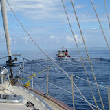
Now, in the early morning , we had come over 300nm from Isla Mujeres but still had about 60 miles to go to arrive at Key West. There was absolutely no wind and the ocean was smooth; without a ripple and we were going nowhere. In checking the weather forecast- there was no wind coming for days, but the Selene was out there somewhere. Just as we were wondering where the trawler was in relation to us, Kathy and John called us on the VHF radio and they were quite close; within a mile! They pulled up close and transferred a doubled 300’ line they had attached to a bridle from their stern. We attached the line as a bridle to our Island Packet and carefully John took up slack. We were moving and moving along well under tow.


Yes, Sea Star, our beautiful sailboat was embarrassingly under tow toward Key West. The Selene pulled us over twenty miles, where we met the Tow Boat US boat, Ranger. After about six hours, after dark, we were safely nudged onto the dock at Conch Marina, Key West.

Thank you Mystic Moon, Tow Boat US and all the friends who met us at the dock to help get us into a safe berth. It took three working days to fix the Yanmar engine. We needed a new water cooling pump, impeller and lots of patience along with our great mechanic who struggled to work on our very inaccessible engine.


After a week we were able to move on from Key West.