Moving on to Yellowstone National Park
Eureka, Montana was a day drive away from our next target. Beartooth Highway at the border of Montana and Wyoming. We had to travel from NW Montana to SE Montana and enter Wyoming. Dan was a bit fatigued from the week of daily 2 up riding in Canada and decided to rest for two days by using the trailer for the bike until we were closer to Beartooth Highway.
We began to repack everything into the car and after food shopping and clothes washing and sorting, packing and sleep we returned the bike to the trailer and set off. Using the major highways we headed south, then east on rt. 90 to 212- the Beartooth!
There was a lot of motorcycle road to cover on the way from Glacier to Yellowstone. Dan had met various bikers along the way who said “ Don’t miss the Million Dollar Rd,” or “If you go into Yellowstone from the East, you should first find the Beartooth Highway. You ride through the Absaroka Wilderness area in Targhee Forest. Best road I ever rode on!”
A full day was necessary to cross Montana and the next night the town of Red Lodge was as far as we would travel. So after dinner in Red Lodge we looked for a place to stay and found a Forest Service campground. As we set up the tent the wind was howling and there had been rain while we ate Mexican food at Red Lodge. The creek we had to pass over to arrive at the campsite was raging as were most of the Montana mountain creeks we passed. Snow cover in the Rockies was said to be higher than normal, with temperatures colder recently, so as the sun and temperatures were increasing, so were the creeks rising. Next morning after breakfast we kept on Beartooth for the 69 mile trip.
BEARTOOTH HIGHWAY
Wikopedia says, "The Beartooth Highway has been called "the most beautiful drive in America," by late CBS correspondent Charles Kuralt.[1] Because of heavy snowfall at the top, The pass is usually open each year only from mid May through mid October because of heavy snowfall at the top, weather conditions permitting.[2]
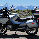
The Beartooth Highway is the section of U.S. Highway 212 between Red Lodge, Montana and Cooke City, Montana. It traces a series of steep zigzags and switchbacks, along the Montana-Wyoming border to the 10,947 ft high Beartooth Pass. The approximate elevation rise is from 5,200 ft in 12 mi in the most daring landscapes.
When driving from the east to the west, the highest parts of the Beartooth Highway level off into a wide plateau near the top of the pass, and then descend to where the Beartooth Highway connects to the Chief Joseph Scenic Byway near Cooke City, which forms the northeast gateway to Yellowstone National Park. En route, one passes numerous lakes typical of the Absaroka-Beartooth Wilderness Area which borders the highway along much of its route.
The highway officially opened June 14, 1936.
Because of the high altitudes, snowstorms can occur even in the middle of the summer and the pass is also known for strong winds and severe thunderstorms. Plan on a driving time of at least two hours for the 69-mile long trip from Red Lodge to Cooke City.
The Beartooth Highway passes through portions of Custer National Forest, and Shoshone National Forest and near the Absaroka-Beartooth Wilderness."
Dan agreed with Charles Kuralt and other riders who either told us not to miss this road or whom we met enjoying the view along the road. It was certainly one of his favorites. Our day was sunny and dry, but a bit windy. The mountains were high, but the road was well kept and traffic not a big issue.
Yellowstone National Park
Our lunch stop in Cooke City finished, we grabbed some ice, a few groceries, and entered Yellowstone National Park from the NE. After the winding driving concentration required during the morning on Beartooth Highway, Dan was pretty tired but we had to drive miles late in the day to find a campsite. There aren’t too many choices for camping near the entrance we used. We drove by the three campgrounds and they all had signs “Full.” It was now summer and Yellowstone is the National Park with highest visitation.
In tired frustration we spoke to a Ranger who had just left work at the Ranger station. Somehow he felt sorry for us when I related the “campground full” story and he suggested that because Dan was on a bike, we could try the hiker/biker section of the Tower Falls campsite, a special section reserved for hikers or bikers since they have fewer options than car campers. We did go to look, and low and behold there was one unoccupied spot and enough room to park. This was much better than driving out of the park and re-entering in the morning, at least 25 miles one way which was our next option!
That evening
we talked for a long while around the campfire with a young man who was
bicycling the Beartooth the next morning.
He was telling us the places he had biked; some of the mountains we had
ridden, but with two strong motors. He was in very good shape,
obviously, but bicycling the Beartooth? Since
he left early and was going the opposite way, we wondered after how he had
done!
In the morning we lurked until a nearby camping family left, grabbed and paid for the now vacant site for a night, so we could go out and explore the park and have a place to come back to. We left the car and set off down the rough campground road to the main loop heading west.
In the morning we lurked until a nearby camping family left, grabbed and paid for the now vacant site for a night, so we could go out and explore the park and have a place to come back to. We left the car and set off down the rough campground road to the main loop heading west.
Yellowstone
has miles of paved road to explore, the road makes a large loop around the park and
off toward the various park entries, meaning to go the entire way around would
be many miles on the bike. We headed to
Mammoth Hot Springs at the North Entrance and would continue around toward Old
Faithful, unless we didn’t get there. There were many turn-offs and vista to
stop and explore.
Unlike many of the National Parks we visited
where we did not have the roads to ourselves, but…the traffic wasn’t too bad, EVERYBODY
wants to be in Yellowstone, making the traffic abominable. RV’s, trailers of all sizes, a gazillion
cars, pickups, 4X4’s and even other motorcycles clog the turn-offs, crowd the
roads and parking lots as they crane their necks to spot the prolific wildlife,
especially the Grizzly bear or Elk then they/we steer off the road in unapproved places,
cameras, scopes and binoculars in hand.
Bison and Black bear can be seen sometimes, too.
Leaving the
campground we bought breakfast at the historic landmark Roosevelt Lodge and Horse Stables, viewing meadows of
tall grasses stretching to the base of low mountains and, at Indian Camp, Alpine
meadows containing small ponds, each pond with its own fly fisherman. The groups and couples enjoying these lessor peopled places appeared tranquil because people were taking time to walk and engage with the surroundings in a different way than the more frantic auto traffic.
I knew Yellowstone was famous for Old Faithful Geyser but there are a lot more than the one geyser in the park. Yellowstone SW road has many places where the ground spews steam over a crusty ground. We found the “hot and steamy” side of the park very interesting with its plumes of steam and incredible pastel rainbow colors. There was even a bubbling caldron of white mud with bubbles bursting six inches above the ground level called the Paint Pot. Geothermal anyone?
I knew Yellowstone was famous for Old Faithful Geyser but there are a lot more than the one geyser in the park. Yellowstone SW road has many places where the ground spews steam over a crusty ground. We found the “hot and steamy” side of the park very interesting with its plumes of steam and incredible pastel rainbow colors. There was even a bubbling caldron of white mud with bubbles bursting six inches above the ground level called the Paint Pot. Geothermal anyone?
The day was
hot, the ground was hot, and the motorcycle was hot especially wearing all the
gear, so we headed back to camp for the day arriving late in the afternoon, and
not reaching Old Faithful. The following
day we started around the loop the opposite way, up the mountain to Dunraven Pass
at 8900ft. There were some RV’s on this
twisty, steep mountain road. They couldn’t
climb the mountain and held up traffic. Passing, even on the bike, was
difficult. We headed now south to Canyon
Village, Lake Village, Yellowstone Lake, a beautiful thirty mile glacier lake
where apparently many types of Salmon and other fish live and the local people
and tourists fish with local guides. In
some places hunting is allowed in the park, too. There were just as many places to stop and
explore or walk –we never made Old Faithful—but that’s OK as we thought we may have to
stand around for a long time, as long as 90 minutes, to see an eruption.
We left the
Park by the South Entrance and headed for Grand Teton National Park, just 60
miles away, much less traveled and another park filled with fabulous
sights; snow covered high mountains and lots of buffalo. At the end of two days in Grand
Teton we left the park and camped at Gros Venture which involved a twenty mile
gravel and dirt road for Dan and a rattletrap jarring for the trailer and me in
the car.
Dan and I were off to western Colorado and our to be last stop; Mesa Verde National Park.
Dan and I were off to western Colorado and our to be last stop; Mesa Verde National Park.
YELLOWSTONE INFORMATION
Established in 1872, Yellowstone National Park is America's first national park. Located in Wyoming, Montana and Idaho, it is home to a large variety of wildlife including grizzly bears, wolves, bison, and elk. Preserved within Yellowstone National Park are Old Faithful and a collection of the world's most extraordinary geysers and hot springs, and the Grand Canyon of the Yellowstone.
Did You Know?
Yellowstone contains approximately one-half of the world’s hydrothermal features. There are over 10,000 hydrothermal features, including over 300 geysers, in the park.
| ||||||||||||
| ||||||||||||


No comments:
Post a Comment